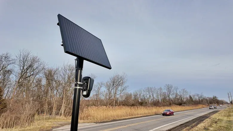

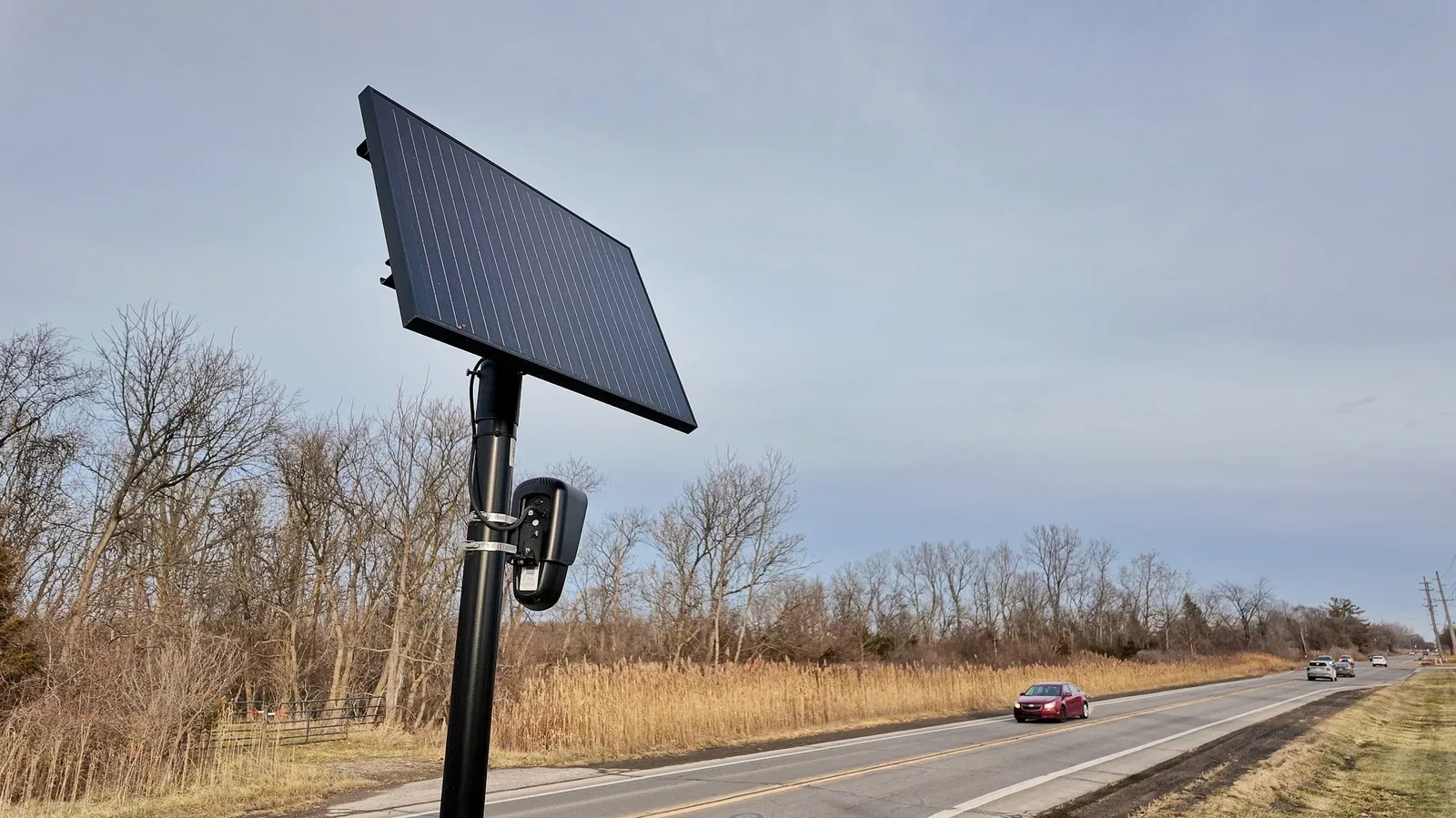
MapQuest has added a new map layer that marks known outdoor surveillance cameras and license plate readers, giving users a more immediate way to see where this infrastructure sits in their neighborhoods and along their usual routes.
The option appears alongside MapQuest’s existing traffic and incident layers. That positioning matters: rather than treating surveillance hardware as an abstract policy issue that only exists in a report or public meeting, the app presents it as geographic information people can place against the roads, blocks and intersections they already know.
For anyone accustomed to reading a game map, the interaction will be immediately familiar. Toggle a layer, add a new kind of point of interest, and reassess the world beneath it. The real-world stakes are of course much more serious than locating a shop, a quest marker or a fast-travel point. But the basic design choice is useful: visibility begins with being able to see the shape of a system.
What the new MapQuest layer shows
The layer identifies known outdoor surveillance cameras and license plate readers. It includes Flock cameras, as well as equipment associated with Motorola Solutions’ Vigilant, Genetec, Axis Communications, Axon, Leonardo’s ELSAG, Neology, Rekor, PlateSmart, Ubicquia and Verkada.
That is a broad list of vendors, and it is important not to flatten the different technologies into one thing. An outdoor surveillance camera is a general term for a camera positioned to monitor a public-facing exterior area. A license plate reader, often abbreviated as LPR or ALPR for automated license plate reader, is more specific: it is designed to capture and interpret license-plate information. The update groups locations of these kinds of known devices into a single practical viewing layer.
“Known” is the operative word. The feature is presented as a map of known locations, not a guarantee that every camera in a city, town or neighborhood is listed. Users should therefore treat it as an informational picture of documented hardware rather than a complete census or a promise of camera-free travel beyond the displayed markers.
That distinction is not a weakness unique to this feature; it is the appropriate way to read most mapped data. Traffic layers are snapshots, incident layers reflect reported events, and a camera layer can only visualize locations that have been identified and incorporated into the map. A missing marker does not establish that no device is present.
A useful layer, not an invisibility switch
The most immediate practical value is awareness. Many people will not be able to substantially change a daily commute, school run or work route because of a marker on a map. Roads still go where roads go, and routines are constrained by time, accessibility and geography. The feature does not claim to offer a reliable way to avoid surveillance cameras, and it should not be understood that way.
Related coverage includes MapQuest Adds Map Layer for Known Outdoor Surveillance Cameras.
Instead, the layer can make the density of this infrastructure easier to grasp. Seeing individual locations on familiar streets may prompt a different set of questions: Are the devices concentrated near a particular junction? How much of a regular route overlaps with known camera locations? Is the distribution more extensive than residents expected?
Those are questions about visibility, not instructions for evasion. The value lies in helping users understand their environment and, if they choose, participate more knowledgeably in neighborhood conversations about surveillance technology.
Why mapping changes the conversation
Lists of vendor names and descriptions of camera programs can be difficult to translate into a lived sense of place. A map is more legible because it attaches a system to locations people recognize. It can turn a vague statement—there are cameras in the area—into a more concrete observation about where documented devices appear.
That has an obvious civic implication. Residents who want to question, support, challenge or simply understand the deployment of cameras in their area need a shared picture of what they are discussing. A map layer does not settle debates over surveillance, privacy or public safety. Nor does it explain every purpose, ownership arrangement or operational detail for every device represented. What it can do is lower the barrier to noticing the infrastructure in the first place.
The gaming comparison is useful only up to a point, but it highlights why this format works. Games regularly teach players to inspect layers of information: terrain, routes, hazards, objectives and nearby activities. A well-built map does not make a choice for the player; it makes the environment more readable. MapQuest’s camera layer applies that same legibility to something people encounter in ordinary public space.
There is also a strong contrast with driving games, where a map is usually about finding the quickest, cleanest or most entertaining line through an environment. Real navigation has more variables. For a look at how digital road spaces can be framed around open driving, see Assetto Corsa EVO’s free-roam update. MapQuest’s addition is not a driving-game feature, though; it is a reminder that the roads represented by maps also contain physical systems that are not always obvious from a windshield.
How to use the feature responsibly
The new layer sits with traffic and incidents, making it relatively easy to locate within the app. A sensible approach is to enable it, examine familiar areas and keep its limitations in mind.
- Use it for context. Compare the markers with places you travel regularly, rather than assuming the map is a complete account of all surveillance equipment nearby.
- Read markers as location information. A mapped point tells users that a known device is associated with that location; it does not, by itself, describe every technical capability, policy or use case tied to it.
- Do not treat absence as confirmation. Because the layer covers known locations, an unmarked street should not be interpreted as surveillance-free.
- Keep safety and legality in view. The practical purpose of an information layer is awareness. It is not a basis for interfering with cameras, entering restricted areas or taking risks while navigating.
This is the same discipline users bring to other map overlays. An incident alert is not a full account of conditions on a road. A traffic color is not a substitute for paying attention while driving. Likewise, camera markers offer a valuable view of known infrastructure without supplying every answer about it.
Part of a broader MapQuest refresh
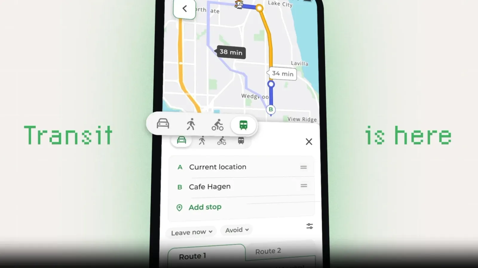
The camera-layer update follows a period of renewed attention for MapQuest. The service drew notice after declining to call Lake Ontario “Lake America,” unlike Google Maps and Apple Maps. It has also added Android Auto support and public-transit directions—features that make the app more useful across different ways of getting around.
Those additions share a common theme: mapping is not merely about plotting a route from one address to another. It is also about deciding what information users can bring into view while they make sense of a place. Transit directions help account for a different kind of trip. Android Auto support brings map functions into a car-oriented interface. The surveillance layer adds another lens onto the streets themselves.
MapQuest introduced the feature with a short video set to Rockwell’s Somebody’s Watching Me, a fittingly direct bit of presentation for a tool about cameras and license plate readers. The joke works because the subject is instantly legible. The more substantive point is that making surveillance locations visible can help people recognize how present such systems are in their own surroundings.
For most users, this will probably be a feature they check occasionally rather than an overlay left on at all times. Even so, it expands what a navigation app can communicate. The best outcome is not panic or false certainty. It is a clearer, more grounded understanding of the known surveillance infrastructure sharing the routes people use every day.