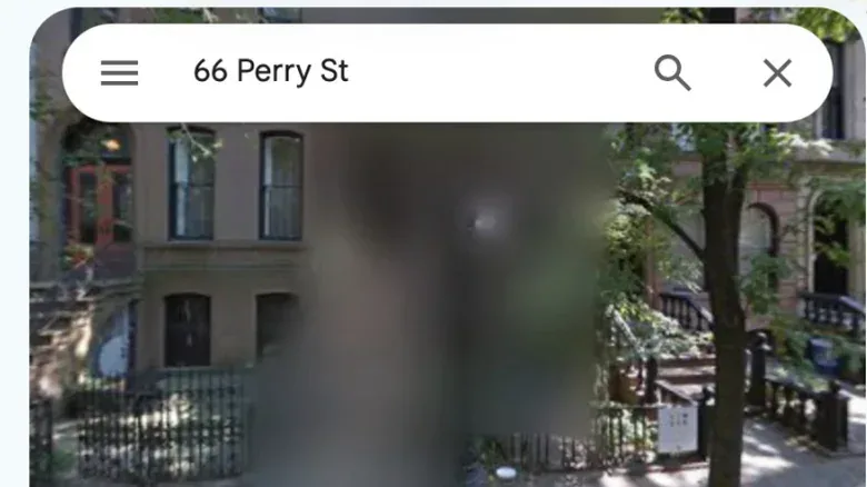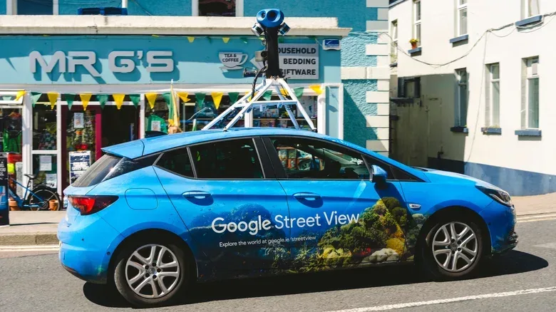

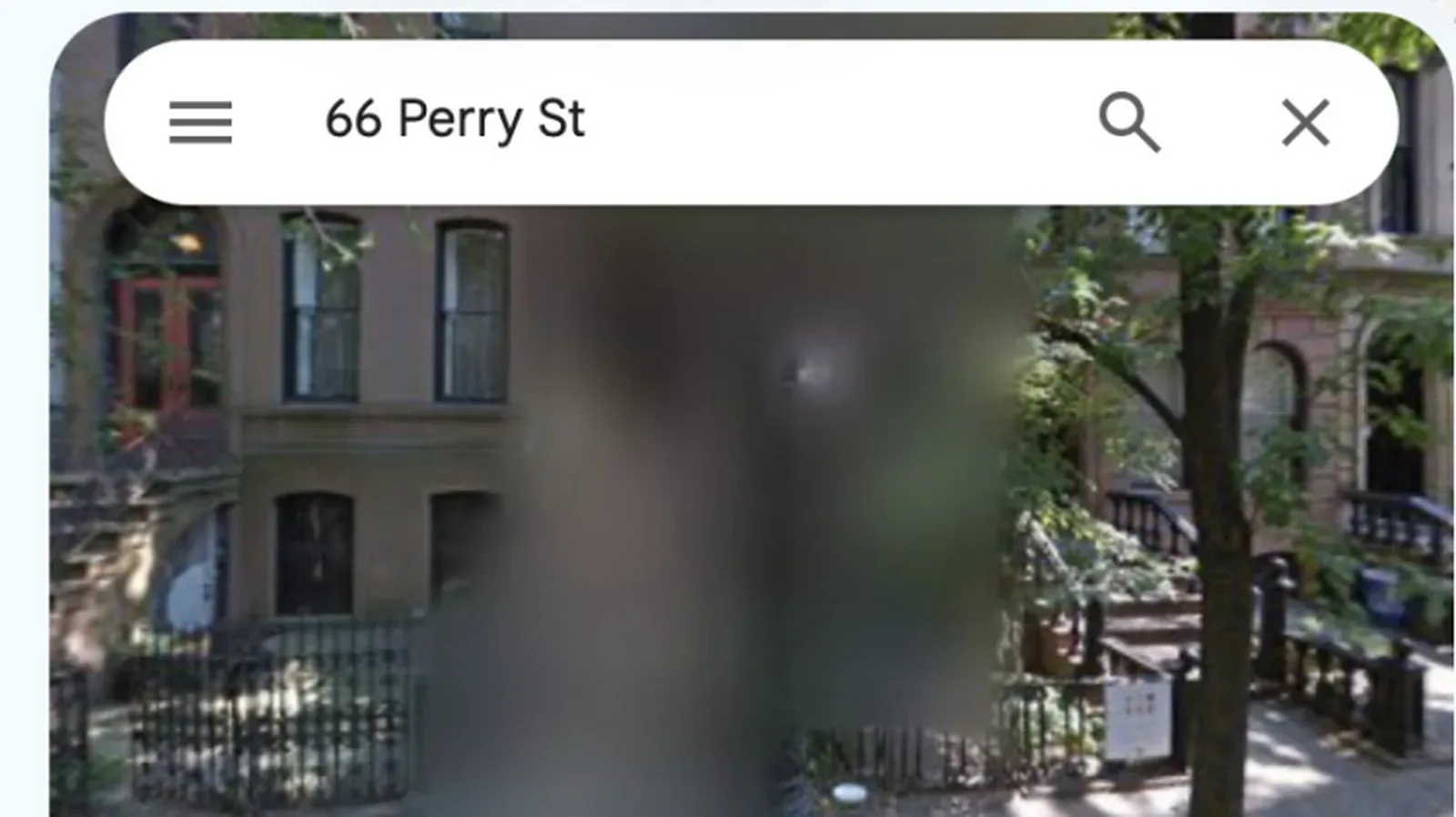
A blurry house, building or patch of road in Google Maps Street View can look like a technical failure at first glance. Often, it is intentional. Google uses blur to conceal selected details in its street-level imagery, balancing the usefulness of a navigable photographic map with privacy and security concerns.
Street View is different from the ordinary map layer: it presents imagery captured from public-facing locations, often with enough visual detail to show a building’s exterior, access points, landscaping, gates and other elements visible from the street. That can be helpful for finding an entrance or recognizing a destination. It can also reveal more about a home or facility than an owner wants preserved in an easy-to-search public service.
For ordinary people, Google already applies automated blurring to faces and vehicle license plates. A larger, deliberate blur covering a property or location has a different purpose. It may follow a request made for privacy, security, legal, or other reasons. It can also be the result of an error, including a request tied to the wrong address.
What Street View blur is designed to hide
Street View blurring is a visual redaction: part of the image is obscured so viewers cannot make out the details underneath. The scope matters. A small blur may cover an individual face or plate, while a broad one can make a whole residence or sensitive structure unrecognizable from the available street-level picture.
Locations that may receive this treatment include military sites and highly secured government facilities. Such places may also be blurred or censored in other Google Earth products. Homes belonging to celebrities, VIPs and wealthy individuals may be blurred, as may residences of people who simply prefer a smaller online footprint. Privacy advocates can make the same choice; the tool is not solely for famous people or institutions.
In the Netherlands and Germany, residents have legal rights to seek blurring of their homes on these kinds of services. That helps explain why a visitor may notice a comparatively large number of blurred properties while browsing imagery there. The underlying principle is straightforward: a public image of a private residence can have consequences even if the exterior could, in theory, be seen by a passerby.
Why a digital footprint matters
A digital footprint is the body of information about a person, place or activity that is accessible through digital services. In this context, it includes the visual record Street View makes easy to locate and revisit. A single street-facing photograph is not a complete security profile, but it can offer clues about layout, visible security measures, apparent property condition, or the kind of access a building has.
That information can be used for entirely legitimate purposes. Police, journalists and open-source investigators may examine publicly available location imagery as part of their work. Open-source investigation means research using material accessible to the public rather than private or classified sources. Yet the same accessibility means criminals could look at the imagery too. Blurring reduces the amount of visual detail retained on that particular Street View view.
It is best understood as one privacy measure, not a universal disappearance button. A blur in Google Maps does not automatically remove other public information about an address, prevent people from seeing the building in person, or alter imagery held by other mapping platforms.
Automatic face and plate blurring versus a property request
Google’s automated systems normally blur faces and license plates in Street View. That baseline protection is intended to avoid exposing identifiable people and vehicle registration details in the imagery. Automation is useful at scale, but it is not infallible. If something was not redacted correctly, a user can request removal through the reporting process.
The same reporting route can be used to ask for a house or other object to be blurred. The key distinction is that a request for a property is a more consequential choice than reporting one missed face or plate: Google does not provide a way to undo location blurring after it has been applied.
That permanence is worth considering before submitting a request. A blurred home can make it harder for casual browsers to inspect it through Street View, but it also means neighbors will not see that part of the street in the service. Future owners or prospective buyers may likewise be unable to view the building through Street View. Those outcomes do not make a request right or wrong; they are trade-offs a resident should weigh against their privacy needs.
How to request a blur for a home or missed detail
The process begins within Street View itself, where the requester can point Google to the precise imagery in question. Be prepared to identify what needs blurring and to provide a way for Google to verify the request.
- Open Google Maps and use Pegman to enter Street View at the relevant location.
- Navigate until the home, face, license plate or other object is visible.
- Open the vertical three-dot menu near the top-left of the Street View window, or select the small Report a problem text at the lower right.
- Reposition the view so the item that needs attention is centered and clearly framed.
- Select the type of item Google should blur.
- Enter an email address for verification.
- Complete the required reCAPTCHA check.
- Provide tenancy or ownership evidence if Google asks for it.
reCAPTCHA is a verification step used to help distinguish a real person making a request from automated activity. The possible request for proof of tenancy or ownership is also significant: a home-blur request concerns a specific property, so a requester may need to demonstrate an appropriate connection to it.
Accuracy is especially important when framing the image and selecting the location. A mistaken address can lead to an incorrect blur, leaving the intended property visible while affecting somebody else’s. A careful check of the Street View position, building and request target before submission is therefore more than routine form-filling.
The permanent part of the decision
Once Google blurs a location in Street View, the service does not offer an option to restore it. That policy gives people confidence that a successful privacy request will not later be casually reversed, but it also removes a potential change of mind. A resident considering the step should treat it as durable rather than as an experimental privacy toggle.
There is another point to approach cautiously. Some observers argue that a blurred property might attract unwanted attention by suggesting the occupant or building is unusually important or valuable. That is a counterintuitive possibility, not a reason to assume a blurred home is a target or contains anything notable. In many cases, the explanation may be mundane: a resident has exercised a privacy right, requested more discretion, or an error has occurred.
The practical question is not whether every building should be visible or hidden. It is whether the benefit of reducing readily accessible visual detail outweighs the loss of a normal Street View view for that particular location. People with elevated privacy concerns may reach a very different answer from people who value a publicly viewable exterior for wayfinding or property research.
Blurring Google Maps does not blur the internet
A successful request applies to Google’s Street View imagery; it does not propagate automatically to Apple Maps, Baidu Maps, Mapillary, Karta View, or any other service that may publish street-level images in a given region. Anyone seeking a broader result needs to consider each provider separately.
For Apple Maps, requests concerning imagery can be sent to MapsImageCollection@apple.com with the requester’s name, address and details of the request. Other services, including Baidu Maps, Mapillary and Karta View, may offer street-level coverage and may allow requests to blur specific locations, depending on region and service policies.
Microsoft’s former Bing Maps Streetside imagery is no longer in place following the transition to Azure Maps, so it is not another active Streetside archive to check in the same way. The broader lesson remains: privacy settings and removal requests are generally platform-specific. Handling a concern in one map does not establish that the same view is absent everywhere else.
Practical privacy housekeeping for map imagery
For someone auditing a home’s public map presence, the sensible first step is to search the address in Street View and see what the imagery actually reveals. Look for missed automatic blurs on faces or plates, and decide whether the property-level view exposes details that create a genuine concern. If the issue is narrowly identifiable information, a targeted report may be more appropriate than asking to obscure an entire home.
It is also useful to separate mapping imagery from broader device and account security. Reducing publicly visible location detail can be one layer of protection, while account settings and software-installation controls address entirely different risks. For example, device security features can sometimes create friction with legitimate app installs, a trade-off explored in this guide to Samsung Galaxy Auto Blocker. The common theme is deliberate choice: understand what a setting or request protects, and what convenience it may affect.
Street View blur is not a signal that something suspicious is happening at an address. It is a tool for managing exposure in a service built to make physical places easy to inspect online. For people who decide they need it, the reporting path is available. For everyone else, the most important detail is simple: make the decision carefully, because Google treats the resulting blur as permanent.