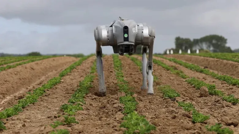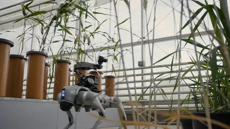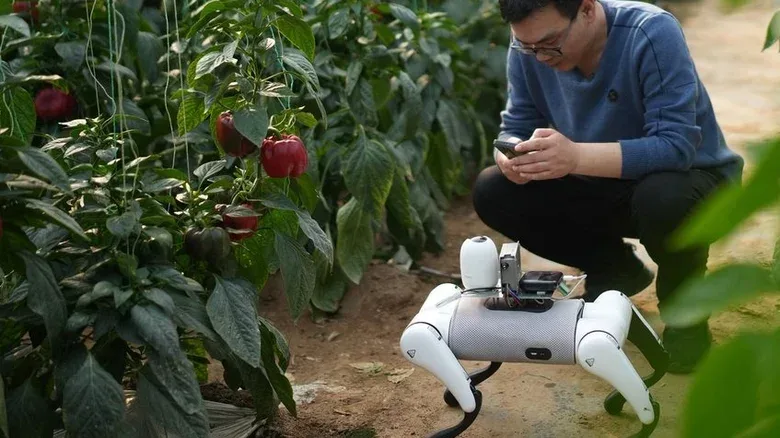

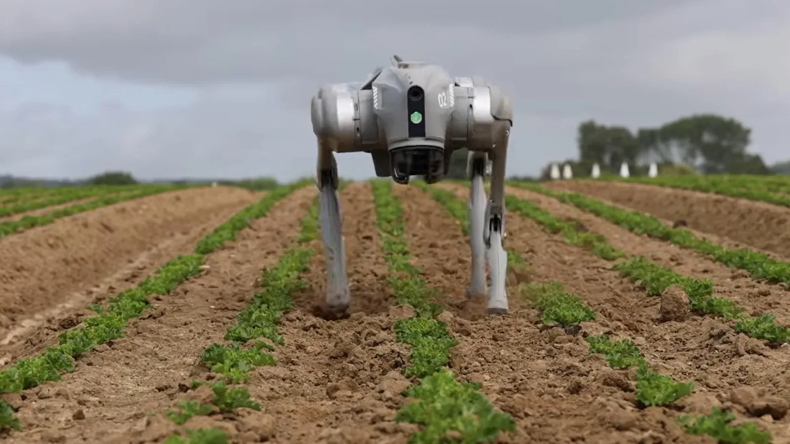
Robot dogs have spent years building a reputation as security machines: four-legged sentries with cameras, sensors and a gait that can feel more science-fictional than practical. Their prospective role in agriculture is much less theatrical, and potentially more consequential. Instead of guarding a perimeter, these machines could move through rows of crops, photograph plants at close range and flag signs of weeds, pests or disease for a person to investigate.
The pitch is not that a quadruped replaces every existing farm tool. It is that it fills a troublesome gap between broad views from satellites, aerial coverage from drones and slow, labour-intensive inspections on foot. In greenhouses especially, airborne systems can be impractical, while wheeled machinery can struggle to move through uneven, wet or crop-dense spaces without creating its own problems.
That makes the robot dog less of a novelty patrol unit and more of a mobile imaging platform. The basic assignment is deceptively straightforward: go where a camera needs to go, repeatedly and without harming the plants; turn those images into organised information; then direct human attention toward places that may need it most.
Whether that translates to dependable day-to-day agricultural value remains an open question. The technology is being developed around a real monitoring burden, but a visual alert is not automatically a diagnosis, and a robot’s efficiency claim is not the same as a proven outcome across every farm. Still, the direction is clear: crop surveillance is becoming another major use case for legged robotics.
The agricultural data gap is at ground level
Farmers and researchers already use several ways to understand crop health and yields. Satellites can reveal large-scale patterns. Drones can cover ground quickly. Phones and manual checks can capture close details. Each approach has trade-offs, however. Satellite imagery is inherently distant; drone operations do not suit every enclosed environment; and a person walking a site and examining plants takes time and resources.
A four-legged machine is intended to operate closer to the crop than aerial imaging while remaining more repeatable than occasional manual inspection. It can collect high-resolution images at plant level and build a time-series record: not just what a leaf or row looked like once, but how it appears across repeated passes. That could be useful when researchers are tracking crop yields, comparing seed varieties or looking for changes that could indicate a developing problem.
Terrain is central to the argument for legs. Conventional rovers and other agricultural machinery may lack the flexibility required for irregular ground or narrow routes between sensitive plants. A quadruped is designed to negotiate wet and muddy conditions and alter its footing, potentially reaching locations that would be awkward for a wheeled platform. The claimed advantage is not speed for its own sake. It is access without unnecessarily damaging a crop.
Greenhouses may be a particularly important setting. They need close observation, but the space is enclosed and can be too sensitive for a drone to be an obvious answer. A compact ground robot could repeatedly scan the same paths and provide another layer of visual coverage alongside phones, fixed equipment and human checks.
What the robot is actually looking at
The agricultural quadruped described by Swiss ag-tech firm Synergenta and the University of Nottingham combines several components that serve different purposes. Multiple cameras capture crop imagery, while spinning LiDAR units help the robot understand the three-dimensional space around it. LiDAR, short for Light Detection and Ranging, sends out laser pulses and measures their returns to construct a model of surrounding terrain and obstacles.
That 3D awareness matters for movement. A robot that is supposed to work around plants needs more than a forward-facing video feed; it needs to recognize the layout of the space around its feet and body. The high-resolution cameras, meanwhile, are the instruments that gather the detailed crop data needed for later analysis.
The system also includes a GPU, or graphics processing unit, to run computer-vision models locally. GPUs were originally associated with rendering graphics, but their ability to perform many calculations in parallel makes them useful for modern AI workloads. In this setting, local processing means the robot can analyse imagery on the machine itself rather than necessarily sending every image elsewhere before producing an initial result.
Computer vision is the part of AI concerned with extracting useful information from images and video. Here, developers say their models can identify weeds, point researchers toward possible disease and support pest detection. “Possible” is the crucial word. Image analysis can highlight a plant or area that warrants a closer look, but the supplied information does not establish that the system can independently confirm a disease or prescribe a treatment.
Rob Lind, identified as a computer vision and AI fellow with Syngenta, describes the underlying idea in unusually vivid terms: “Plants speak to us in the language of the light.” In practical terms, the project is trying to read visual signals that a crop may reveal through its appearance. The important next step is connecting those detected patterns to an action a farm or research team can take.
From images to useful farm decisions
Collecting imagery is only the first half of the job. A farm gains little from a huge folder of photographs unless those photographs become a dataset that supports decisions. That is why developers are focused on AI vision models and agricultural data mapping rather than simply attaching cameras to a robot.
A useful system would need to make its findings easy to interpret: where a suspected weed, pest or disease indicator was seen; when it was seen; and whether the area appears to be changing over time. The robot’s potential value is strongest when it shortens the path between a subtle visual change in the field and a human decision to inspect, test or intervene.
This could be particularly relevant to phenotyping, the study of observable traits in plants. In crop research, that can mean examining how varieties differ in visible characteristics and performance under particular conditions. Frequent, consistent imaging could provide researchers with a richer record of crop development than sporadic manual surveys alone.
The wider ambition includes invasive pests, weed spotting and crop-killing diseases—problems where delayed detection can be costly. But the evidence supplied here supports the robots as tools for detection and research assistance, not as a complete solution to those challenges. A camera model may notice something abnormal; a person still needs to determine what it means and how to respond.
That distinction should shape expectations. In agriculture, false positives can send workers to inspect healthy plants, while missed detections can leave a genuine problem unnoticed. The hard work is not just training a model to recognize an image category. It is proving that the alerts are reliable enough, in changing light, weather, crop stages and field conditions, to earn a place in an established workflow.
Not a replacement for every other sensor
Lind’s own description points toward integration rather than substitution. He characterizes the quadruped as an additional imaging platform in a network that already includes satellites, drones and phones. That is a more grounded framing than treating robot dogs as a universal agricultural answer.
Each platform views the farm at a different scale. Satellites offer broad coverage. Drones can survey from above. A phone can document a specific plant in a worker’s hand. A robot dog occupies the middle ground: close enough to capture detail, mobile enough to revisit routes, and able to operate at ground level in a greenhouse or field.
There are already adjacent examples of animal-like robotics being used to gather environmental information. Volkswagen has deployed robotic sheep to examine agrivoltaics at a Polish solar farm. Agrivoltaics refers to combining agricultural activity with solar power infrastructure on the same land. Elsewhere, AI-enabled quadrupeds in China have been used to detect invasive fire ant populations, while robot dogs in Italy have been put to work cleaning public beaches. The common thread is not that every job needs legs; it is that legs can be valuable where surfaces, layouts and access routes are difficult.
The broader trust problem facing AI systems also applies here. An AI tool that classifies images must be transparent enough for its operators to understand what it has flagged and why it needs verification. That challenge is different from consumer-facing identity systems, but the need for accountable design is similar to issues raised by AI misclassification and trust concerns in other technology deployments.
Promised productivity, and the labour question
The strongest case for robot dogs is their potential to reduce the burden of repetitive inspection. Disease and invasive-species detection can demand sustained human attention, and late or inconsistent checks can lead to errors. A machine capable of operating repeated shifts could gather more observations than a team can reasonably manage on foot.
DEEP Robotics said in August 2026 that its robot dog could cut manual workloads for grape growers in China’s Turpan region by 70 percent. That is a company-stated result rather than a general benchmark for agriculture. It should not be read as proof that every crop, terrain or operation will see the same reduction. Even so, it indicates the kind of workload change developers are seeking: less time spent on routine scanning, with people concentrating on the investigations and choices that follow.
That shift has a clear labour dimension. If quadrupeds take over some inspection routes, farms may require fewer hours of physical scouting. The technology could remove repetitive work, but it could also displace workers whose expertise has been essential to recognising problems in the field. The relevant question is not simply whether a robot can walk a route overnight. It is who owns the resulting data, who validates its recommendations, and whether productivity gains are accompanied by protections and meaningful roles for workers.
A more realistic near-term model is a mixed workflow. Robots gather imagery and raise alerts. Agronomists, researchers and farm workers inspect the signals, apply their knowledge of local conditions and decide what happens next. That is consistent with the project’s stated vision of adding a new imaging layer rather than eliminating every existing one.
An early-stage field with big claims to test
Synergenta is not the only group pursuing agricultural quadrupeds. Researchers at the University of Minnesota, North Carolina A&T and Purdue are also developing versions of the idea. That breadth matters because it suggests a growing technical interest in moving AI vision closer to crops, rather than relying solely on images acquired from above or occasional human observation.
There are still unanswered practical questions. It is unclear whether a potential FCC restriction on imaging technologies similar to those used in drones would affect quadrupeds. The available information also does not establish how these robots perform over long periods, how often they need maintenance, or how their findings compare with expert field inspections under varied real-world conditions.
Those limits do not erase the opportunity. They define the work left to do. Legged robots may make it easier to observe crops in places where satellites, drones and wheels each fall short. AI vision may help make that flood of close-range imagery manageable. But agricultural usefulness will depend on the quality of the data, the reliability of the detection models and the people responsible for acting on what the machines find.
For now, the robot dog’s most credible agricultural role is not farmyard mascot or autonomous crop doctor. It is a persistent, careful scout: one more set of eyes on the ground, designed to make scarce human attention count where it matters most.