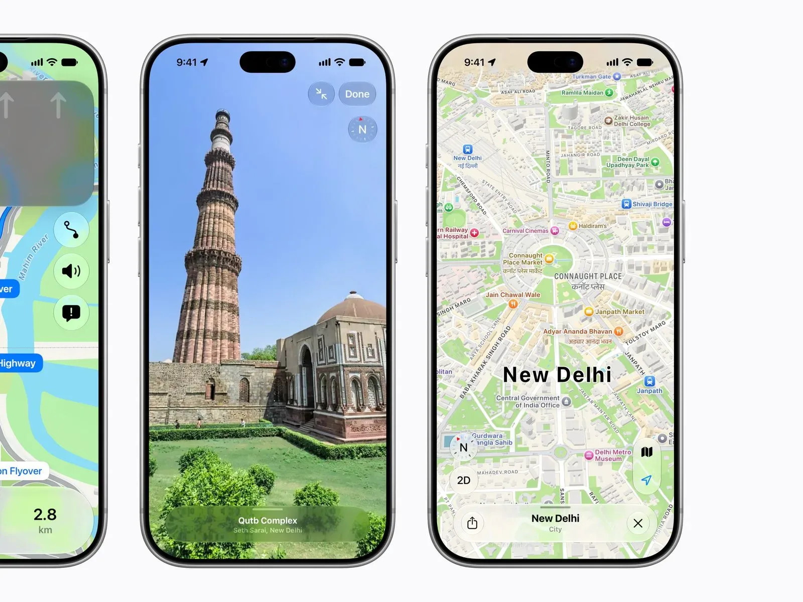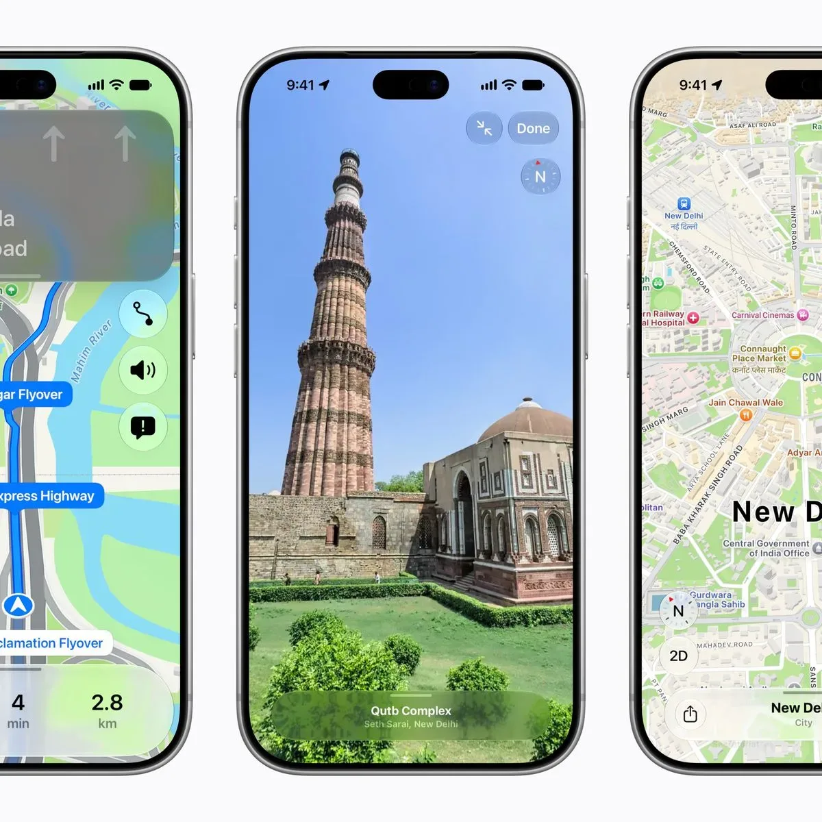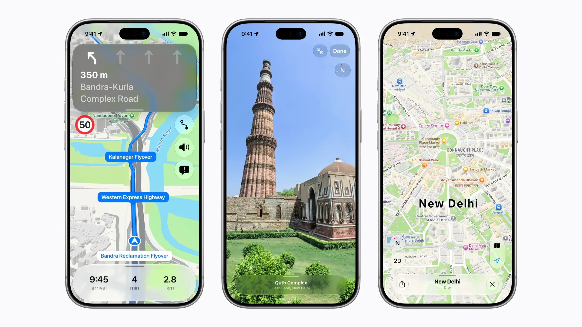

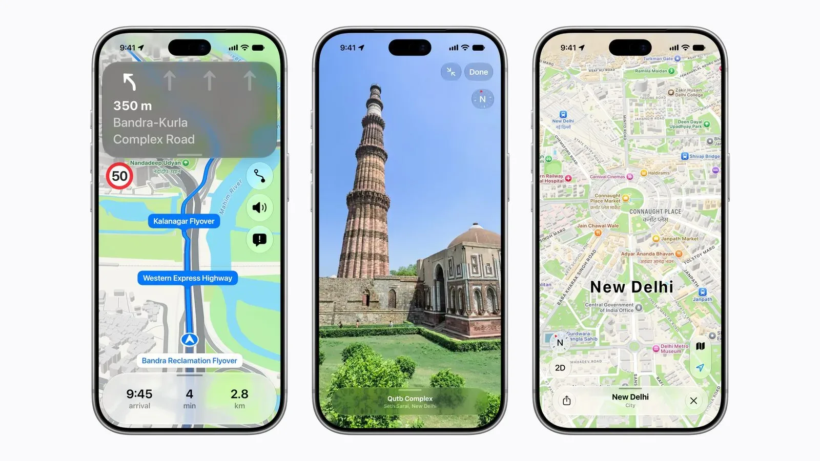
Apple Maps’ redesigned map experience is now rolling out across India, bringing a much broader set of navigation and discovery tools to the country than its earlier turn-by-turn offering. The update combines the expected visual refresh—more detailed roads, buildings, parks and shopping centres—with features that attempt to handle the practical realities of navigating places where a street name alone may not be the most useful instruction.
The new map includes more than 300 three-dimensional landmarks and is described as offering faster, more accurate navigation. But the most meaningful element of the rollout is not simply the number of 3D models. It is a set of localised navigation features: enhanced Natural Language Guidance, dual-language place labels, street-level Look Around imagery and expanded transit information.
It is also a notable expansion of Apple’s mapping work in India. The company opened a Maps-focused development centre in Hyderabad in 2016, while turn-by-turn navigation reached India in 2019. The redesigned Apple Maps first arrived in the United States in 2018 and subsequently expanded to other countries; India had remained outside that newer map experience until this rollout.
Directions that use the landmarks people actually notice
Apple’s Natural Language Guidance is designed to phrase directions more conversationally than a bare distance-and-turn command. A conventional instruction might tell someone to turn at the next junction. The India-specific version can make use of real-world reference points, including pillars, petrol pumps and other points of interest. That means Maps can potentially give a direction such as turning after a petrol pump, including on roads where names are unavailable or do not offer a practical cue to a driver.
This is an important distinction in how a navigation system communicates rather than merely how it draws a route. A map can know the destination and still give an instruction that is difficult to act on at speed. Landmark-based phrasing seeks to connect the route on a screen with the visible environment around the person travelling. It is particularly relevant where named-road data is less helpful to a driver than a prominent local feature.
Natural Language Guidance in this context means spoken or presented route instructions expressed in a more human-style form. It should not be confused with a guarantee that every route will have a landmark-based prompt. Apple says the guidance has been enhanced with those real-world details; the usefulness of a particular trip will necessarily depend on the road, the available map data and which relevant points of interest are nearby.
The enhanced Natural Language Guidance requires iOS 27.2, iPadOS 27.2, watchOS 27.2 or macOS 27.2 or later. That requirement matters for people who see the new map design but do not immediately receive the locally tailored phrasing: the underlying operating-system version is part of the feature’s availability.
Dual-language labels reflect regional road-sign conventions
The map also displays place names in English and the local language used in a region, echoing the way road signs can present names. In addition to English and Hindi, supported languages are Bengali, Gujarati, Kannada, Malayalam, Marathi, Tamil, Telugu, Punjabi, Odia and Urdu.
That is more than a cosmetic text option. Labels are a core part of map comprehension: a person may recognise a local-language name on a road sign, while a visitor may be relying on English text to confirm the same location. Showing both together can reduce the awkward gap between what a phone displays and what is visible outside the vehicle or on a station sign.
As with enhanced Natural Language Guidance, dual-language labels need one of Apple’s version 27.2 operating-system releases or later. Users planning to rely on the feature should therefore check both their software version and the language settings appropriate to their region rather than assuming every label will change automatically.
Look Around and AR walking guidance arrive
India is also receiving Look Around for the first time. Look Around is Apple Maps’ interactive street-level imagery feature, using high-resolution 3D photography to let people examine an area from a ground-level perspective. The capability can be useful before setting out: it gives a traveller another way to identify the frontage of a building, understand an intersection or get a clearer sense of where a destination sits relative to surrounding streets.
Apple says the imagery can be viewed by users anywhere in the world, not solely by people physically located in India. That makes it potentially useful for remote trip planning as well as immediate local navigation. Still, street-level imagery is best understood as an orientation aid, not a replacement for paying attention to current conditions on the ground.
AR Walking Directions are joining the service as well. AR, short for augmented reality, refers here to an iPhone displaying step-by-step walking guidance as an overlay on the real-world view when the user raises the device. It is aimed at the familiar pedestrian-navigation problem of working out which way to start walking after leaving a station, turning onto an unfamiliar road, or arriving at a dense junction.
In practice, the safety implication is straightforward: the overlay may help establish direction, but it does not remove the need to watch traffic, surfaces and other pedestrians. It should be used to orient oneself, rather than as a reason to keep a phone held up while walking.
Tools for drivers, cyclists and multi-stop plans
Several other navigation functions are part of the India update:
- Lane guidance can help drivers prepare for the correct lane ahead of a turn or interchange.
- Multi-stop routing supports routes with as many as 15 stops. Routes can sync from a Mac or iPad to an iPhone.
- Share ETA lets a user share an estimated arrival time with another person.
- Cycling directions include elevation details, which can help riders judge the character of a route beyond its distance.
- Electric-vehicle routing can plan a journey around charging stops.
- Drivers can report accidents, hazards and speed checks hands-free through Siri AI.
The multi-stop feature may be especially practical for people handling errands or a series of appointments. Rather than separately launching navigation for each location, they can construct a single itinerary of up to 15 points. Syncing between Mac, iPad and iPhone means that planning can begin on a larger display and then travel with the user on their phone.
Lane guidance is a different sort of improvement: it deals with the last moments before a turn, when a route that looks simple from above can become confusing in motion. Meanwhile, cycling elevation details add a useful layer of context. Two routes of similar length need not demand the same effort, and elevation data can make that difference clearer before a rider commits to one.
EV routing is intended to account for charging stops while planning a trip. The supplied details do not specify compatible vehicle systems, charger coverage or how charging recommendations are selected, so users should treat it as a route-planning tool and verify charging arrangements for a particular journey.
Transit coverage spans eight cities and Indian Railways
Transit planning is available in Ahmedabad, Bengaluru, Chennai, Delhi, Hyderabad, Kolkata, Mumbai and Pune, as well as on Indian Railways. Riders can plan journeys, locate nearby stations and receive a notification when it is time to get off.
For transit users, the last of those functions addresses a simple but common concern: not missing the correct stop when travelling on an unfamiliar route. The station-discovery option, meanwhile, may be helpful at the beginning of a journey when someone is on foot and needs to find the nearest viable access point.
The listed cities and Indian Railways define the announced transit availability. They should not be read as a claim that all forms of local transit in every Indian city are included. For a specific journey, travellers should confirm that the route and service they need appear in Maps before depending on it.
What the rollout changes—and what users should check
The central idea behind the new experience is that maps work best when they fit the way people understand their surroundings. Detailed cartography and 3D landmarks make a map easier to scan, but the India-specific work goes further by pairing regional-language labels with directions grounded in visible features. That combination could make the service more legible for daily navigation, visiting a new neighbourhood or coordinating a route with someone using local reference points.
For Apple-device users, the practical checklist is short: update to the required 27.2 software release if dual-language labels or enhanced Natural Language Guidance are priorities; use Look Around to familiarise yourself with unfamiliar areas; and review a route before travelling, particularly when a trip involves several stops, charging or transit connections. The company’s broader ecosystem integration is also relevant, with planned multi-stop routes able to move from Mac or iPad to iPhone.
This expansion arrives as Apple continues to build features around the iPhone, iPad and Mac ecosystem. For more Apple-related coverage, see the report on Apple’s rumoured 20th-anniversary iPhone designs.
Apple Maps’ new India experience is available starting now. Its value will ultimately rest on the reliability of the map and route data in the places people travel most, but the announced feature set shows a clear emphasis on making navigation instructions better match Indian roads, signs and languages rather than simply importing a generic global map design.