
A small circled Z in Google Maps can carry a much bigger consequence than an ordinary navigation symbol. When it appears in route details, it means the planned drive passes through a low-emission zone, often shortened to LEZ. These zones commonly cover central urban areas and may restrict, charge, or require special documentation for vehicles based on their emissions.
The important part is not simply seeing the icon. Drivers need to establish whether their specific vehicle is permitted under the rules of the city they are entering. Google Maps can flag that a zone lies on the route, but it does not know a car’s emissions class and cannot confirm compliance. Treat the Z as an early warning to check the official local guidance before setting off.
What the circled Z means in Google Maps
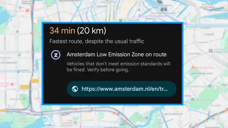
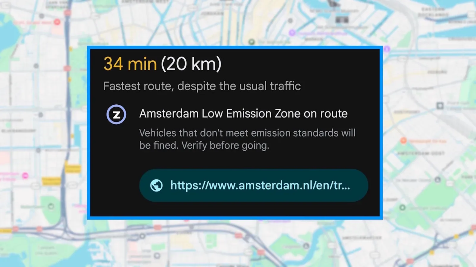
The Z denotes a low-emission zone on the route. A route into central Amsterdam, for example, can show the symbol beneath the estimated trip time alongside a notice that an Amsterdam low-emission zone is on the way. The app warns that vehicles failing to meet the applicable standards can be fined, and it provides a link to the city’s official information.
That placement matters. The icon is route information, not a claim that every car is prohibited from continuing. It tells a driver that a regulation boundary is relevant to the trip. The eligibility question remains separate, because the answer depends on the vehicle and the local scheme.
For more context, explore Queen Latifah’s Rock Hall Induction Is a Celebration—and a Challenge to Who Was Left Out.
A low-emission zone is an area—usually in or around a city centre—where older or more polluting vehicles face restrictions. The form of those restrictions can vary considerably. A city may bar particular diesel vehicles, apply a charge above a certain pollution threshold, or require a windscreen sticker identifying the vehicle’s emissions class.
In other words, “LEZ” is a category of policy, not one identical rulebook used everywhere. Two cities can both trigger a Z warning while imposing different requirements. That is why a driver should not assume that a vehicle permitted in one place will automatically qualify in another.
Why the alert deserves attention
Driving across borders already means adapting to unfamiliar signs, road conventions, and city rules. Low-emission zones add another layer because the relevant criteria are often tied to details a navigation app cannot infer from a destination alone: the vehicle’s emissions classification, fuel type, registration status, or whether a sticker is required.
The practical risk is a fine for entering with a vehicle that does not meet the standard. The warning is therefore best understood as a planning prompt rather than something to dismiss once the route has started. A few minutes spent checking the linked city page may determine whether the direct route is suitable, whether documentation must be arranged, or whether another way of reaching the destination makes more sense.
The underlying feature has been part of Google Maps since 2021 on Android and iOS. Its first version used a circled lowercase i, before changing to the capital Z now seen in route details. Initial coverage included low-emission zones in Germany, the Netherlands, France, Spain, and the UK.
In 2025, Google said it would expand coverage to more than 1,000 low-emission and low-traffic zones across Europe, including locations in Italy, Sweden, and Austria. That expansion makes the marker more useful for cross-border journeys, but also makes it more important not to reduce its meaning to a single universal rule.
What Google Maps does—and does not—tell you
Google Maps provides the location-based part of the decision: it identifies that the selected route crosses a regulated area and directs the driver toward official details. It does not compare a car’s emissions class against the applicable standard.
That limitation is worth keeping clear, especially for travellers who expect navigation software to function like a complete driving-permission checker. The map knows the route geometry and the zone boundary. It does not know whether a particular car has the credentials required to enter.
- The Z tells you: a low-emission zone is on the planned route.
- The city’s guidance tells you: which vehicles qualify, what restrictions apply, and whether a sticker, charge, or other requirement is involved.
- Your vehicle information tells you: whether the car meets those conditions.
Keeping those roles separate prevents a common mistake: assuming that because Maps has offered a route, that route is automatically lawful for every vehicle. Route availability and vehicle eligibility are not the same thing.
A sensible checklist when the symbol appears
If the circled Z appears while planning a drive, deal with it before beginning the journey. The following approach follows directly from what the alert is designed to communicate.
- Open the information linked from the route notice. The official city page is the appropriate place to see the standards for that particular zone.
- Check the vehicle against those standards. Do not rely on a broad assumption that a newer, rented, foreign-registered, petrol, or diesel vehicle will be accepted; the city’s criteria are the relevant criteria.
- Identify any administrative requirement. Depending on the location, compliance may involve a sticker on the windscreen, a charge, or another condition.
- Review Google Maps’ alternative routes. If the vehicle does not qualify, a route avoiding the zone may be available.
- Consider parking outside the boundary. Parking beyond the LEZ and completing the journey by public transit is another option when driving into the restricted area is unsuitable.
This is particularly valuable for trips with a fixed arrival time. Discovering a restriction only when approaching a city centre can force a last-minute reroute, while checking before departure leaves time to compare the direct drive, an avoidance route, and a park-and-transit plan.
Rental cars need an extra question
Rental vehicles create a straightforward but easily overlooked issue: the person driving may not know enough about the car’s emissions classification or clearance for local schemes. Before taking a rental into an area where the Z appears, ask the rental company whether the vehicle is approved for low-emission zones on the intended trip.
That question is more useful than treating the Z as a generic caution. It focuses on the actual compliance issue: whether that particular rental car can enter the relevant zone under the relevant local rules. If the answer is unclear, planning an alternative route or stopping outside the boundary avoids turning an uncertainty into a possible penalty.
Low-emission and low-traffic zones are not interchangeable
The expanded Google Maps coverage described by Google includes both low-emission and low-traffic zones. The circled Z discussed here specifically signals a low-emission zone on the route. It should not be read as a catch-all explanation for every kind of traffic restriction a European city may use.
The distinction matters because the reason for a restriction shapes the rules a driver must verify. An LEZ is concerned with vehicle emissions and can therefore be tied to emissions standards, bans, fees, or stickers. A low-traffic zone is a different kind of managed area and should be checked on its own terms where relevant.
For drivers, the broad lesson is simple: map alerts are useful signals, but they are not substitutes for reading the city’s requirements. The Z is doing the helpful part—raising the flag before the route reaches the regulated area. The driver still has to confirm whether the car is eligible and choose a route accordingly.
The bottom line for European road trips
When Google Maps shows a circled Z, it is not indicating a zebra crossing, rest point, or a setting within the app. It means the route enters a low-emission zone. Since local rules can range from vehicle bans to charges or sticker requirements, the correct next step is to use the route notice to check the city’s official information.
For an eligible vehicle, the alert may only require a quick confirmation. For an ineligible or uncertain vehicle, it is a reason to select an alternative route, arrange the correct documentation where applicable, or leave the car outside the zone and continue by public transit. In a navigation app used by more than two billion people monthly, it is a small marker with a very practical purpose: helping drivers notice a rule before that rule becomes an expensive surprise.